In the direction of La Verna (about 15 km from Sant'Agata), the route is interrupted by a landslide. Until the competent authorities ensure the safe restoration of the road, we invite you to use the detour described here.
A very beautiful and scenic route entirely on short stretches of asphalt roads with little traffic that are sometimes bumpy, mule tracks, dirt roads and single tracks with a medium/high level of difficulty and where extreme care must be taken, especially on downhill stretches.
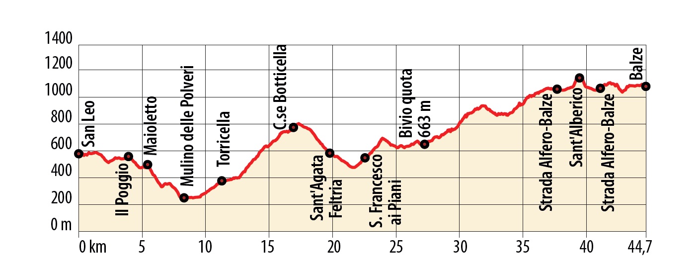
Notes
The gradient in some of the uphill sections between Torricella and Botticella is high, but you can easily dismount and push your bike in these stretches.
In certain rainy periods, take care as the ground can become very heavy and muddy (and can become impassable) on the ridges between Le Iole and La Rocca di Maiolo and between Poggio Villa Verde and Case San Martino.
Please also note that you should ride very carefully on the following downhill stretches and if you aren’t comfortable, get off your bike and walk:
- From Maiolo cliff to Cà Migliore
- From Cà Migliore to Polveri Mill (bridge over the Marecchia River)
- From Madonna del Soccorso to Sant’Agata Feltria
In Sant’Agata Feltria, bikers from Piazza Fabbri should take an immediate left onto Via Del Ricovero, descend straight for about 500 metres and take the signposted route, first on an asphalt road and then a diversion to the left, onto a dirt road.
At Cà l’Abate, beware of the dogs, contact the Gabrielli family tel. +39 0541 929179.
The route is easy and can be cycled in its entirety, as far as Sant’Alberico Hermitage car park.
To reach the hermitage, there is an initial stretch (about 100 metres) of very steep, uneven road that climbs to the left of the car park, dismount and push your bike. After 500 metres uphill and downhill through the forest. you’ll reach the hermitage.
From the hermitage to Balze there is an uphill mule track that is fairly short (about 800 metres), but very challenging due to the rocky and uneven terrain, followed by a difficult, very technical descent (rocks, steps and boulders) for experienced bikers only.
We advise less experienced mountain bikers not to venture beyond the Hermitage of Sant’Alberico and to return to the car park and take the asphalt road (about 3 km) to Balze.
(Source: Vincenzi Primo Gianni, Cristian Reali, Matteo Panzeri)